• Home
  • Discover South Park
    • Explore the South Park National Heritage Area Map
    • South Park Heritage Experience Series
    • South Park Heritage Magazine
    • Towns & Communities
      • Alma
      • Como
      • Fairplay
      • Hartsel
      • Jefferson
      • Lake George
    • Natural Resources
    • Prehistory
    • Mountain Men
    • Mining
      • Prunes the Burro of Fairplay, Colorado
    • Ranching
    • Railroad
  • Grants
    • Grants
    • Grant Guidelines
    • Grant Application
  • Education & Programs
    • Historic Preservation
      • Tarryall-Cline Ranch Restoration Project
      • Paris Mill
      • Old Courthouse
      • Park County Local History Archives
    • Events
  • Get Involved
    • Magazine Submissions
    • Volunteer Interest Form
    • Internships
    • Partners & Volunteers
  • About SPNHA
    • Contact
    • Board of Directors
    • Management Plan
    • Acknowledgements
  • Blog
  • Donate
    • Tarryall-Cline Ranch Restoration Project
Where is South Park?
southparkheritage@gmail.com
Message Us on Facebook!
South Park National Heritage AreaSouth Park National Heritage Area
  • Home
  • Discover South Park
    • Explore the South Park National Heritage Area Map
    • South Park Heritage Experience Series
    • South Park Heritage Magazine
    • Towns & Communities
      • Alma
      • Como
      • Fairplay
      • Hartsel
      • Jefferson
      • Lake George
    • Natural Resources
    • Prehistory
    • Mountain Men
    • Mining
      • Prunes the Burro of Fairplay, Colorado
    • Ranching
    • Railroad
  • Grants
    • Grants
    • Grant Guidelines
    • Grant Application
  • Education & Programs
    • Historic Preservation
      • Tarryall-Cline Ranch Restoration Project
      • Paris Mill
      • Old Courthouse
      • Park County Local History Archives
    • Events
  • Get Involved
    • Magazine Submissions
    • Volunteer Interest Form
    • Internships
    • Partners & Volunteers
  • About SPNHA
    • Contact
    • Board of Directors
    • Management Plan
    • Acknowledgements
  • Blog
  • Donate
    • Tarryall-Cline Ranch Restoration Project

Explore the South Park National Heritage Area Map

South Park is a landscape shaped by centuries of human history, natural forces and the communities that continue to call this part of Colorado home. The South Park National Heritage Area map offers a way to see many of those stories together, from historic ranches and mining sites to railroads, reservoirs, wildlife areas and scenic routes.

Use the map below to explore the South Park National Heritage Area and discover some of the places that help tell the story of this remarkable landscape.
south_park_nha_public_boundary_map
View Full-Resolution Map

South Park National Heritage Area Within Park County

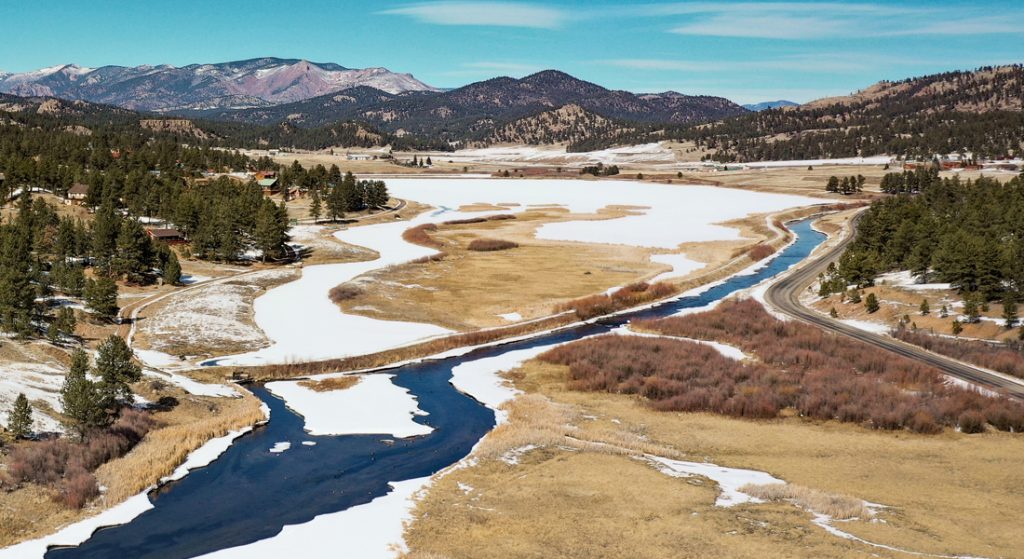
The South Park National Heritage Area stretches across a large portion of Park County, encompassing the broad South Park basin and many of the historic communities, transportation routes and landscapes associated with the region.

On the map, the National Heritage Area boundary is outlined in purple, making it easy to see how the designated area relates to communities including Fairplay, Alma, Como, Jefferson, Hartsel, Lake George and Guffey. The map also shows nearby communities such as Bailey, Grant, Shawnee and Pine Junction, helping provide geographic context for the heritage area within the larger county.

Rather than representing a single historic site, the National Heritage Area brings together a much larger cultural landscape. Historic ranches, mining communities, railroad corridors, homesteads, scenic areas and waterways are all part of the story represented on the map.

A Map Filled With South Park History

Look closely and the map becomes much more than a way to find towns and highways.

Historic railroad sites such as the Como Depot and Roundhouse, Jefferson Depot and Midland Railroad Tunnels appear alongside remnants of South Park’s mining history, including the Paris Mill, London Mill, Magnolia Mill and Leavick Mill.

The map also identifies places connected to ranching and settlement, historic schools and churches, museums and galleries, pioneer cabins and numerous natural and scenic areas. Several historic driving routes are marked as well, including the Boreas Pass, Buckskin Gulch, Mosquito Pass, Horseshoe/Fourmile and Weston Pass Historic Auto Tours.

Together, these places help illustrate how geography, transportation, industry and settlement shaped South Park over time.

See the Map Come to Life

Some of the places shown on this map are also featured in our South Park Heritage Experience video series.

Windy Ridge and South Park’s Ancient Bristlecones

Near Alma, the map identifies the Bristlecone Pine Scenic Area, part of a high-elevation landscape where ancient bristlecone pines have endured generations of extreme weather and changing conditions.

Our Windy Ridge Bristlecone Pines video takes a closer look at this remarkable landscape, its history and why protecting sensitive places like Windy Ridge matters.

Elevenmile Canyon: History Along the South Platte

On the eastern side of the heritage area near Lake George, the map traces the Elevenmile Canyon Scenic & Historic Auto Tour and shows Eleven Mile Reservoir and other historic and natural features of the surrounding landscape.

Our Elevenmile Canyon in Lake George, Colorado South Park Heritage Experience explores how this dramatic canyon became part of the region’s transportation and recreation story, connecting its historic past with the landscape visitors see today.

Explore South Park’s Heritage

The South Park National Heritage Area contains far more than can be represented by any single map. But this map provides a starting point for understanding how the region’s communities, historic sites, transportation corridors and natural landscapes connect.

Whether you’re researching South Park history, planning to explore the region or simply curious about a place you’ve seen along the road, use the map to discover another piece of South Park’s story.

Download the Full-Resolution Map

Recent Posts

  • Windy Ridge Bristlecone Pine Scenic Area: South Park’s Ancient Forest
  • What Is This Massive Steel Structure at Paris Mill?
  • Rare and Resilient: South Park’s Native Wildflowers Tell a Deeper Story
  • 2026 SPNHA Grant Applications Now Open!
  • 📰 Now Available: Read the Fall/Winter 2025 Edition of Our Magazine
Want to help our preservation efforts in South Park? Donate Today!

ABOUT US

Discover the magic of South Park’s heritage, history and resources. South Park’s historic communities, pristine valleys, and lofty mountain peaks reflect times long past and host rare natural features just waiting to be discovered.
Share your SPNHA photos with us @southparknha_co!

© 2020 · South Park National Heritage Area · Design by Mt. Bailey Productions LLC | Donate Today!